Training on Remote Sensing Field Techniques and Ground Truthing
Course Overview
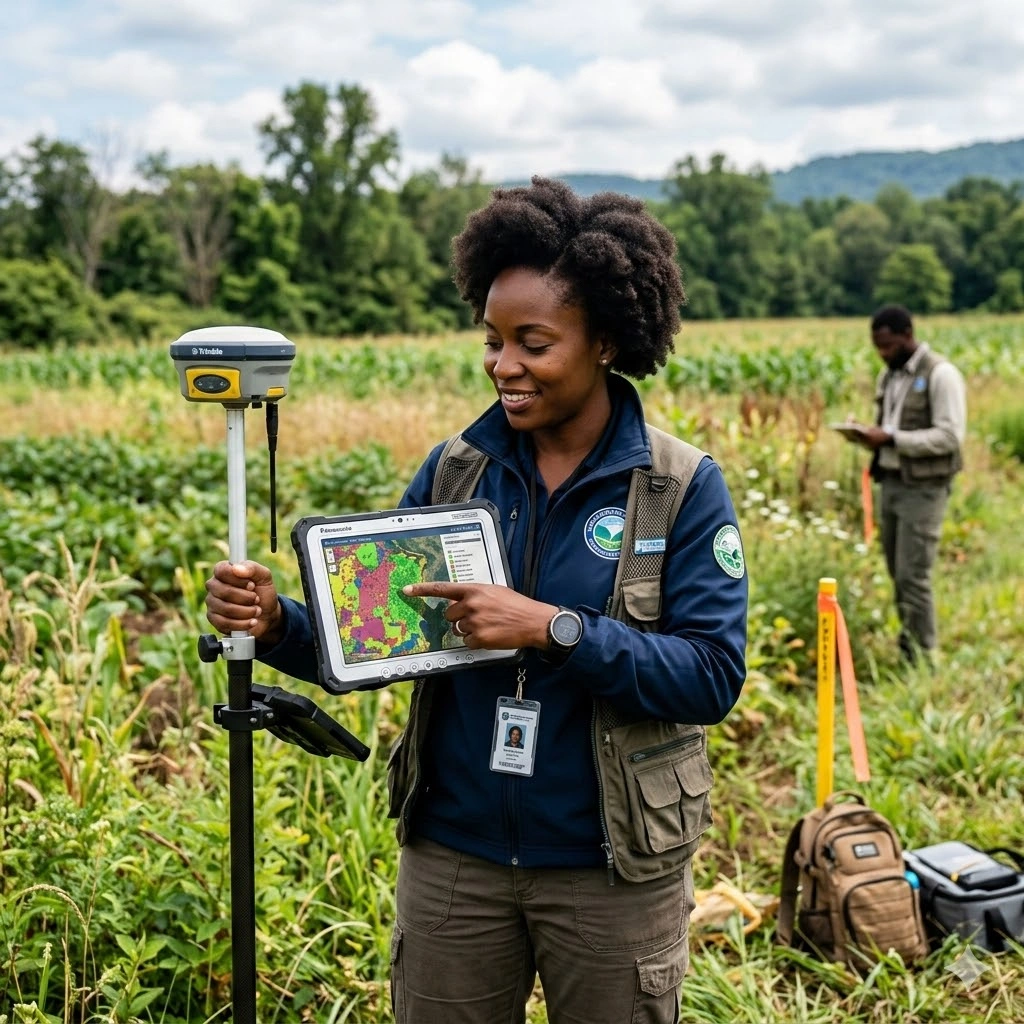
This course equips participants with practical skills in remote sensing field techniques and ground truthing to ensure high-accuracy geospatial analyses. Participants will learn how to design and implement field surveys, collect environmental and land use data using GPS devices, drones, and field sensors, and integrate field measurements with satellite and aerial imagery. The training emphasizes the importance of accurate field verification for validating remote sensing data in environmental monitoring, agriculture, forestry, and disaster management applications.
The program covers essential field protocols, sampling design, quality assurance, and techniques for linking spectral data to on-the-ground measurements. Participants will gain hands-on experience in planning survey campaigns, executing field measurements, and managing field-collected datasets for integration with GIS and remote sensing platforms. Real-world case studies demonstrate how ground truthing enhances the reliability of spatial analyses and decision-making processes.
Additionally, participants will explore methods for integrating remote sensing products with field data to support environmental monitoring, climate change studies, land use planning, and natural resource management. By the end of the 10-day course, attendees will be able to design and execute field data collection programs, validate remote sensing outputs, and apply verified geospatial data for informed, evidence-based decision-making.
Duration
10 Days
Who Should Attend
• Remote sensing and GIS professionals
• Environmental scientists and natural resource managers
• Forestry and agriculture specialists
• Disaster risk management practitioners
• Urban and regional planners
• Climate change researchers
• Field surveyors and monitoring officers
• Graduate students and researchers in geospatial sciences
Course Impact
Organizational Impact
-
Improved accuracy of geospatial data products for planning and monitoring
-
Stronger capacity to validate and calibrate satellite imagery with field data
-
Enhanced decision-making for agriculture, forestry, urban development, and disaster response
-
Reduced dependency on external consultants for field validation exercises
-
Increased credibility of reports and assessments through scientifically validated data
Individual Impact
-
Proficiency in ground truthing and field validation methods
-
Ability to design and execute field campaigns effectively
-
Practical skills in using GPS, drones, and field sensors
-
Confidence in integrating field data with remote sensing products
-
Enhanced career prospects in geospatial research and applied project work
Course Objectives
By the end of this course, participants will be able to:
-
Understand the principles and importance of ground truthing in remote sensing
-
Design and implement field surveys for data collection
-
Operate GPS, UAVs, and other field instruments for ground validation
-
Apply sampling strategies for accuracy assessment
-
Integrate field data with remote sensing imagery for classification and calibration
-
Conduct sector-specific applications in agriculture, forestry, climate, and disaster risk management
Course Outline
Module 1: Introduction to Remote Sensing and Ground Truthing
-
Role of ground truthing in remote sensing projects
-
Accuracy assessment and validation frameworks
-
Overview of tools: GPS, UAVs, spectroradiometers
-
Case study: Validating land cover maps with field surveys
Module 2: Field Survey Design and Sampling Strategies
-
Random, stratified, and systematic sampling techniques
-
Planning field campaigns and selecting sites
-
Dealing with accessibility and logistical challenges
-
Case study: Sampling design for agricultural crop surveys
Module 3: GPS and Mobile Data Collection Tools
-
Using handheld GPS and mobile apps for georeferencing
-
Data logging and error minimization techniques
-
Introduction to open-source field data collection platforms (e.g., ODK, KoboToolbox)
-
Case study: Collecting geospatial data for urban mapping
Module 4: UAVs and Drone-Based Field Techniques
-
Drone operations for high-resolution mapping
-
Flight planning, data capture, and safety protocols
-
Processing UAV imagery and linking with ground data
-
Case study: UAV-based crop health monitoring
Module 5: Spectral Measurements and Field Sensors
-
Spectroradiometers and field spectrometers
-
Measuring vegetation indices, soil properties, and water quality
-
Linking field spectral signatures with satellite imagery
-
Case study: Forest canopy health assessment
Module 6: Data Quality Control and Error Assessment
-
Common sources of field data errors
-
Techniques for minimizing positional and measurement errors
-
Field data verification and documentation standards
-
Case study: Accuracy assessment of land use/land cover classification
Module 7: Integration of Field Data with Remote Sensing Imagery
-
Georeferencing and integrating field points with imagery
-
Ground truthing for supervised classification
-
Calibration of vegetation indices using field data
-
Case study: Crop yield estimation with remote sensing and field data
Module 8: Sector Applications of Field Techniques
-
Agriculture: crop monitoring, yield forecasting
-
Forestry: biomass estimation, deforestation monitoring
-
Urban: infrastructure mapping, informal settlement validation
-
Disaster management: flood and landslide verification
-
Case study: Multi-sector applications in climate resilience
Module 9: Emerging Tools and Technologies
-
Mobile GIS applications for real-time data collection
-
Cloud-based data integration (Google Earth Engine, ArcGIS Online)
-
AI and machine learning for field data processing
-
Case study: Using AI for automated ground truth data collection
Module 10: Field Project Design and Best Practices
-
Developing a field data collection workflow
-
Ethical and safety considerations in fieldwork
-
Documentation, reporting, and data sharing protocols
-
Group project: Designing a field campaign plan for agriculture, forestry, or urban planning
Prerequisites
Course Administration and Investment
Whether you join us in a physical boardroom or through our virtual campus, we’ve designed every administrative detail for a seamless, professional experience.
Our fees are all inclusive during course hours.
- Covered: High level tuition, comprehensive materials (digital + physical), mid morning and afternoon refreshments, a full executive lunch, and any scheduled study visits or site tours.
- Not covered: Travel, visa fees, medical/travel insurance, personal expenses, and accommodation.
From registration to the classroom, we keep things clear and efficient.
- Registration: Find your preferred schedule, click “Register,” complete the form, and submit. Need help? Talk to us directly.
- Pre Course Assessment: After registering, you’ll receive a diagnostic survey to help facilitators tailor content to your needs.
- Joining Instructions: Once fees are paid, you’ll receive a Delegate Welcome Pack at least 7 days before the start date (venue maps, virtual access links, and pre reading materials).
We provide premium environments optimized for adult learning and networking.
- Physical Venues: Premium 4 star and 5 star executive boardrooms across our global host cities, with high tier catering.
- Virtual Instructor Led Training (VILT): High definition, interactive platforms featuring breakout rooms, digital whiteboards, and live technical support.
- NITA and Regulatory Compliance: Administrative processes align with national training authorities.
You’ll leave with tools that extend the course value far beyond the final day.
- ForElite Learner Kit: A physical or digital course manual, proprietary templates, and a curated toolkit of industry standard SOPs.
- On Site / In App Support: Dedicated course coordinators handle technical, dietary, or logistical inquiries in real time.
We validate your commitment to excellence with internationally recognized credentials.
- Attendance Tracking: Rigorous daily logging to meet corporate and regulatory accreditation requirements.
- Verifiable Credentials: Upon successful completion, you receive a certificate of course completion.
Our relationship with you doesn’t end when the course closes.
- Feedback & ROI Reporting: Detailed post course evaluations to give sponsors clear insight into training impact.
- Alumni Network Access: Every delegate joins the ForElite Alumni Network for ongoing peer to peer learning and exclusive webinars.
When is the next intake?
UpdatedWe offer customized training solutions tailored to your organization's specific needs (location, dates, content and team size).
Talk to us and we’ll guide you on the best schedule and format for your team.
Training Methodology
We turn knowledge into results. Using our P.E.A.K. Framework (Prepare, Engage, Apply, Know), every participant leaves with practical skills they can use immediately.
Proven Impact
In the last 12 months, over 1,200 professionals have applied the P.E.A.K. Framework to reduce onboarding time by an average of 30% and accelerate project delivery across 14 industries.
The outcome: Participants don’t just learn. They gain the tools, confidence, and strategy to drive measurable impact.
Tailor-Made Training and Customization
Off-the-shelf solutions rarely fit perfectly. At ForElite Training Institute, we built our Tailor-Made Training (TMT) service to embed our expertise directly into your unique strategy, culture, and operations.
We replace generic examples with scenarios from your sector (e.g., public sector, NGOs, financial services, or logistics).
Choose a format that fits your operations: intensive 3 day bootcamps or weekly sessions that minimize work disruption.
We teach directly from your actual templates, brand guidelines, or financial reports.
Host your bespoke training in any of our 21+ global cities, or we'll send facilitators to your office anywhere in the world.
Course Reviews
Share your experience to help others choose the right course.
Leave a Review
Your review will be published after verification.
Most Recent Reviews
Showing the most recent reviews.
Training on Remote Sensing Field Techniques and Ground Truthing FAQs
Quick answers to common questions about this course
You May Also Be Interested In
Explore more courses in this category
 Advanced
 Intermediate
 Foundation
 Advanced
Intermediate
Foundation
Advanced
Advanced
Advanced
Intermediate
Foundation
Advanced

SECURE YOUR COMPETITIVE ADVANTAGE TODAY.
Subscribe to the Premier Intel newsletter for weekly market insights and training updates.
About Us


ForElite Training Institute is a global institutional capacity-building and EdTech partner that empowers organizations and professionals with transformative, high-impact learning.
Explore
Mastery Tracks
More Mastery Tracks
