Training on Spatial and Spectral Data Fusion: Techniques for Enhanced Remote Sensing Analysis

Course Overview
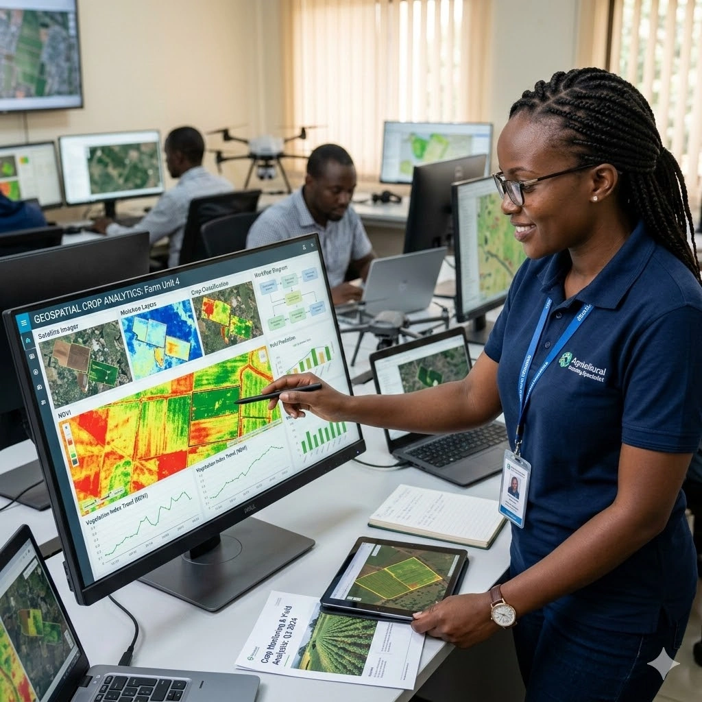
This course provides participants with advanced skills in fusing spatial and spectral datasets to enhance remote sensing analysis. Participants will gain hands-on experience integrating data from multiple sources; including optical imagery, radar, LiDAR, and hyperspectral datasets—to improve accuracy, resolution, and insight for complex geospatial problems. Emphasis is placed on practical workflows, from data preprocessing and alignment to feature extraction and predictive modeling.
Participants will explore software tools such as ENVI, ERDAS Imagine, QGIS, Python, R, and Google Earth Engine to implement fusion techniques. The training covers applications across agriculture, forestry, climate monitoring, disaster management, and urban planning, demonstrating how combined datasets can produce more reliable maps, detect changes, and support data-driven decisions. Real-world case studies provide context for applying advanced fusion techniques to operational scenarios.
By the end of the 10-day course, attendees will be able to design and execute spatial and spectral data fusion workflows, integrate multi-source remote sensing datasets, and generate actionable insights for environmental monitoring, urban development, and resource management. Participants will also gain the confidence to optimize data for improved predictive modeling, monitoring, and reporting across diverse geospatial applications.
Duration
10 Days
Who Should Attend
• Remote sensing and GIS specialists
• Environmental scientists and ecologists
• Urban and regional planners
• Agricultural monitoring and food security professionals
• Climate change and disaster risk management practitioners
• Data analysts and researchers in Earth observation
Course Impact
Organizational Impact
-
Improved capacity to conduct high-quality, data-driven remote sensing analysis
-
Enhanced decision-making through precise land cover classification and monitoring
-
Ability to integrate multiple datasets for improved accuracy in environmental reporting
-
Strengthened institutional expertise in applying cutting-edge geospatial technologies
Individual Impact
-
Advanced technical skills in spatial and spectral data fusion techniques
-
Hands-on experience with software tools for remote sensing data integration
-
Broader ability to interpret complex datasets for practical applications
-
Competitive advantage in research, consulting, and professional growth in geospatial fields
Course Objectives
By the end of this course, participants will be able to:
-
Understand the theoretical basis of spatial and spectral data fusion
-
Apply different fusion techniques to integrate multi-source datasets
-
Use remote sensing software (e.g., ENVI, ERDAS, Python, R) for data fusion workflows
-
Interpret fused datasets for applications in agriculture, forestry, urban planning, and climate studies
-
Critically analyze case studies and design customized data fusion strategies
Course Outline
Module 1: Fundamentals of Spatial and Spectral Data Fusion
-
Principles of fusion: spatial vs. spectral trade-offs
-
Data sources overview (optical, radar, LiDAR, hyperspectral)
-
Tools: QGIS, ERDAS Imagine
-
Datasets: Landsat 8/9, Sentinel-2 MSI
-
Case Study: Land cover classification improvement through fusion
Module 2: Preprocessing and Data Preparation
-
Geometric, radiometric, and atmospheric corrections
-
Image registration and co-alignment
-
Tools: ENVI, SNAP (ESA’s Sentinel Application Platform), Python (GDAL, rasterio)
-
Datasets: Sentinel-1 SAR, Sentinel-2 optical
-
Case Study: Preparing SAR-optical data for fusion workflows
Module 3: Pixel-Level Fusion Techniques
-
Brovey, IHS, PCA, wavelet transforms
-
Strengths and limitations of pixel-based methods
-
Tools: ENVI, MATLAB, Python (NumPy, OpenCV)
-
Datasets: Landsat 8 panchromatic + Sentinel-2 multispectral
-
Case Study: Enhancing resolution of urban imagery
Module 4: Feature-Level Fusion
-
Extraction of indices (NDVI, NDWI), texture, radar features
-
Combining extracted features for analysis
-
Tools: Python (scikit-image, rasterio), R (raster, caret)
-
Datasets: MODIS NDVI + Sentinel-1 SAR
-
Case Study: Crop health monitoring through feature fusion
Module 5: Decision-Level Fusion
-
Integration of multiple classifier outputs
-
Ensemble machine learning techniques
-
Tools: Python (scikit-learn, TensorFlow, PyTorch)
-
Datasets: Hyperspectral (AVIRIS) + LiDAR (USGS Lidar)
-
Case Study: Disaster damage mapping using decision-level fusion
Module 6: Hyperspectral and Multisensor Fusion
-
Handling high-dimensional hyperspectral datasets
-
Integration with LiDAR data
-
Tools: ENVI, Python (spectral library), MATLAB
-
Datasets: AVIRIS hyperspectral + LiDAR elevation data
-
Case Study: Wetland mapping with hyperspectral-LiDAR fusion
Module 7: Radar and Optical Data Fusion
-
SAR-optical integration to overcome cloud/weather challenges
-
Applications in flood and urban studies
-
Tools: SNAP, QGIS, Google Earth Engine
-
Datasets: Sentinel-1 SAR + Sentinel-2 MSI
-
Case Study: Flood risk mapping with SAR-optical fusion
Module 8: Advanced Computational Techniques
-
AI/ML for fusion (Random Forest, SVM, CNNs, Autoencoders)
-
Cloud computing workflows for large-scale data
-
Tools: Google Earth Engine, AWS Earth on Demand, Python ML libraries
-
Datasets: Landsat archive + Sentinel time-series
-
Case Study: Deep learning for multi-sensor land cover mapping
Module 9: Applications in Climate and Sustainable Development
-
Using fused datasets to monitor climate change
-
Applications in urban heat islands, deforestation, biodiversity monitoring
-
Tools: QGIS, Google Earth Engine
-
Datasets: MODIS, Landsat, Sentinel, LiDAR
-
Case Study: Tracking deforestation with multisensor fusion
Module 10: Project Design and Future Trends
-
Designing real-world data fusion workflows
-
Emerging trends: UAV integration, AI-driven fusion, real-time analysis
-
Linking fused data to policy and decision-making
-
Tools: Mixed (ENVI, QGIS, Python, GEE)
-
Datasets: User-selected regional datasets
-
Case Study: Smart city monitoring using multi-sensor fusion
Prerequisites
Course Administration and Investment
Whether you join us in a physical boardroom or through our virtual campus, we’ve designed every administrative detail for a seamless, professional experience.
Our fees are all inclusive during course hours.
- Covered: High level tuition, comprehensive materials (digital + physical), mid morning and afternoon refreshments, a full executive lunch, and any scheduled study visits or site tours.
- Not covered: Travel, visa fees, medical/travel insurance, personal expenses, and accommodation.
From registration to the classroom, we keep things clear and efficient.
- Registration: Find your preferred schedule, click “Register,” complete the form, and submit. Need help? Talk to us directly.
- Pre Course Assessment: After registering, you’ll receive a diagnostic survey to help facilitators tailor content to your needs.
- Joining Instructions: Once fees are paid, you’ll receive a Delegate Welcome Pack at least 7 days before the start date (venue maps, virtual access links, and pre reading materials).
We provide premium environments optimized for adult learning and networking.
- Physical Venues: Premium 4 star and 5 star executive boardrooms across our global host cities, with high tier catering.
- Virtual Instructor Led Training (VILT): High definition, interactive platforms featuring breakout rooms, digital whiteboards, and live technical support.
- NITA and Regulatory Compliance: Administrative processes align with national training authorities.
You’ll leave with tools that extend the course value far beyond the final day.
- ForElite Learner Kit: A physical or digital course manual, proprietary templates, and a curated toolkit of industry standard SOPs.
- On Site / In App Support: Dedicated course coordinators handle technical, dietary, or logistical inquiries in real time.
We validate your commitment to excellence with internationally recognized credentials.
- Attendance Tracking: Rigorous daily logging to meet corporate and regulatory accreditation requirements.
- Verifiable Credentials: Upon successful completion, you receive a certificate of course completion.
Our relationship with you doesn’t end when the course closes.
- Feedback & ROI Reporting: Detailed post course evaluations to give sponsors clear insight into training impact.
- Alumni Network Access: Every delegate joins the ForElite Alumni Network for ongoing peer to peer learning and exclusive webinars.
When is the next intake?
UpdatedWe offer customized training solutions tailored to your organization's specific needs (location, dates, content and team size).
Talk to us and we’ll guide you on the best schedule and format for your team.
Training Methodology
We turn knowledge into results. Using our P.E.A.K. Framework (Prepare, Engage, Apply, Know), every participant leaves with practical skills they can use immediately.
Proven Impact
In the last 12 months, over 1,200 professionals have applied the P.E.A.K. Framework to reduce onboarding time by an average of 30% and accelerate project delivery across 14 industries.
The outcome: Participants don’t just learn. They gain the tools, confidence, and strategy to drive measurable impact.
Tailor-Made Training and Customization
Off-the-shelf solutions rarely fit perfectly. At ForElite Training Institute, we built our Tailor-Made Training (TMT) service to embed our expertise directly into your unique strategy, culture, and operations.
We replace generic examples with scenarios from your sector (e.g., public sector, NGOs, financial services, or logistics).
Choose a format that fits your operations: intensive 3 day bootcamps or weekly sessions that minimize work disruption.
We teach directly from your actual templates, brand guidelines, or financial reports.
Host your bespoke training in any of our 21+ global cities, or we'll send facilitators to your office anywhere in the world.
Course Reviews
Share your experience to help others choose the right course.
Leave a Review
Your review will be published after verification.
Most Recent Reviews
Showing the most recent reviews.
Training on Spatial and Spectral Data Fusion: Techniques for Enhanced Remote Sensing Analysis FAQs
Quick answers to common questions about this course
You May Also Be Interested In
Explore more courses in this category
 Intermediate
 Intermediate
 Intermediate
 Intermediate
Intermediate
Intermediate
Intermediate
Intermediate
Intermediate
Intermediate
Intermediate
Intermediate

SECURE YOUR COMPETITIVE ADVANTAGE TODAY.
Subscribe to the Premier Intel newsletter for weekly market insights and training updates.
About Us


ForElite Training Institute is a global institutional capacity-building and EdTech partner that empowers organizations and professionals with transformative, high-impact learning.
Explore
Mastery Tracks
More Mastery Tracks
