Training on Sensor Integration and Geosensing for Advanced Remote Sensing Applications
Course Overview
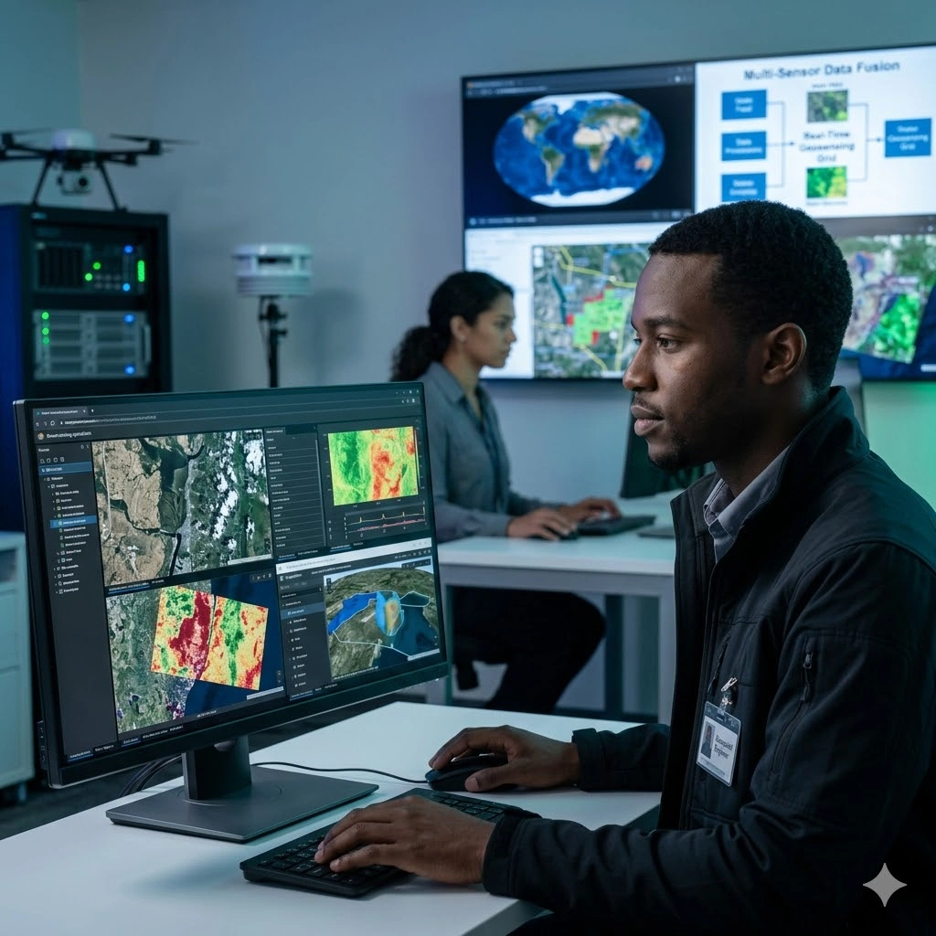
What is Sensor Integration and Geosensing in Remote Sensing?
Sensor integration and geosensing refers to the coordinated use of multiple geospatial sensing technologies such as satellite sensors, UAV/drones, LiDAR, and ground-based IoT sensors to collect, synchronize, and analyze Earth observation data. It enables high-resolution, real-time, and multi-source spatial intelligence for advanced remote sensing applications.
Remote sensing systems often operate in silos, with disconnected sensor outputs, inconsistent data formats, and limited real-time integration. This reduces analytical accuracy, delays decision-making, and limits the ability to respond effectively to environmental, infrastructural, and disaster-related events.
This course provides a practical framework for integrating and optimizing geospatial sensor systems. Participants will learn how to configure and calibrate sensors, harmonize multi-source datasets, and apply advanced spatial analytics to generate accurate, real-time insights for strategic decision-making.
Key Concepts Covered
• Fundamentals of geosensing and sensor networks
• Satellite, UAV, LiDAR, and IoT sensor integration
• Sensor calibration, configuration, and optimization
• Multi-source spatial data fusion techniques
• Real-time data acquisition and processing
• Remote sensing data interpretation and validation
• Advanced spatial analytics and modeling
• Applications in environmental and infrastructure monitoring
Participants will apply skills to:
• Monitor environmental changes using integrated sensor systems
• Support disaster detection and early warning systems
• Assess infrastructure conditions using remote sensing data
• Improve land and resource management decisions
• Enable real-time spatial intelligence dashboards
• Support climate change monitoring and sustainability planning
By the end of the course, participants will be able to integrate and manage geospatial sensor systems, process multi-source remote sensing data, and generate high-precision spatial insights for environmental, infrastructure, and disaster-related decision-making.
Duration
10 Days
Who Should Attend
• Remote sensing professionals
• GIS analysts and spatial data scientists
• Environmental engineers and climate specialists
• Research scientists in geospatial technologies
• UAV/drone operators and analysts
• Infrastructure and urban monitoring specialists
• Government and NGO technical officers in geospatial programs
Course Impact
Personal Impact
-
Enhances high-level technical competence in sensor integration and geosensing
-
Builds capability to lead geospatial technology innovation projects
-
Increases proficiency in spatial data interpretation and technical problem solving
Organizational Impact
-
Improves accuracy in environmental and operational monitoring
-
Strengthens capacity to conduct real-time geospatial assessments
-
Enhances strategic planning and risk mitigation using advanced sensing technologies
-
Supports innovation and digital transformation in remote sensing systems
Course Objectives
By the end of this course, participants will be able to:
-
Integrate multiple sensor types for high-precision remote sensing applications
-
Calibrate and configure sensor systems for different environmental and operational contexts
-
Analyze, process, and interpret sensor-derived spatial data
-
Apply geosensing for real-time monitoring, risk assessment, and field operations
-
Implement best practices in sensor integration for scalable geospatial projects
-
Develop analytical frameworks using advanced remote sensing technologies
Course Outline
Module 1: Fundamentals of Remote Sensing and Sensor Integration
-
Overview of remote sensing systems and sensor technologies
-
Types of sensors (optical, LiDAR, radar, thermal, UAV-based)
-
Principles of geosensing and its role in advanced spatial analytics
-
Case Study:Review of global sensor-based remote monitoring projects
Module 2: Data Acquisition Techniques Using Multisource Sensors
-
Using satellite, aerial, and ground sensors for high-resolution data capture
-
Real-time and near-real-time data acquisition systems
-
Precision challenges and data acquisition best practices
-
Practical Exercise:Compare spatial data capture methods using different sensor types
Module 3: Sensor Calibration, Configuration, and Optimization
-
Calibration procedures for ensuring data accuracy
-
Sensor alignment and integration in multi-platform environments
-
Error minimization and signal quality improvement techniques
-
Case Study:Calibration challenges in climate monitoring sensors
Module 4: Geosensing Technologies and Internet of Things (IoT) Integration
-
Introduction to IoT-enabled geospatial sensors
-
Real-time geospatial streaming and monitoring networks
-
Integration with cloud GIS and smart infrastructure systems
-
Practical Exercise:Develop a configuration workflow for IoT sensor integration
Module 5: Spatial Data Processing and Interpretation
-
Processing raw sensor data for analysis (raster, point cloud, spectral)
-
Using GIS and remote sensing tools for spatial analytics (ArcGIS, ENVI, QGIS)
-
Advanced techniques: 3D modeling, terrain analysis, multispectral imaging
-
Case Study:Data interpretation for agricultural risk detection
Module 6: Advanced Remote Sensing Applications
-
Applications in natural resource management, agriculture, urban studies, and climate science
-
Smart monitoring systems for environmental change tracking
-
Remote sensing for infrastructure development and safety assessment
-
Practical Exercise:Design a geosensing architecture for project implementation
Module 7: Real-Time Monitoring and Sensor-Based Early Warning Systems
-
Building sensor networks for environmental and operational alerts
-
Disaster prediction using remote sensing and geospatial data
-
Automated detection systems for floods, droughts, and wildfire risks
-
Case Study:Early warning implementation using integrated sensor systems
Module 8: Data Integration and Decision Support Systems
-
Integrating sensor data into GIS, spatial dashboards, and decision-making tools
-
Visualization and reporting for executive-level communication
-
Linking field data to remote sensing analysis
-
Practical Exercise: Produce a sensor-based decision support model
Module 9: Quality Assurance, Policy, and Data Governance
-
Data quality control frameworks and risk management
-
Legal and ethical considerations in sensor-based monitoring
-
Compliance with professional and organizational standards
-
Case Study:Data governance in national remote sensing programs
Module 10: Strategic Project Design and Technology Implementation
-
Designing scalable sensing applications for real-world operations
-
Innovation planning and technology lifecycle management
-
Aligning sensor-based systems with organizational goals
-
Practical Exercise: Develop a strategic sensor integration proposal
Prerequisites
Course Administration and Investment
Whether you join us in a physical boardroom or through our virtual campus, we’ve designed every administrative detail for a seamless, professional experience.
Our fees are all inclusive during course hours.
- Covered: High level tuition, comprehensive materials (digital + physical), mid morning and afternoon refreshments, a full executive lunch, and any scheduled study visits or site tours.
- Not covered: Travel, visa fees, medical/travel insurance, personal expenses, and accommodation.
From registration to the classroom, we keep things clear and efficient.
- Registration: Find your preferred schedule, click “Register,” complete the form, and submit. Need help? Talk to us directly.
- Pre Course Assessment: After registering, you’ll receive a diagnostic survey to help facilitators tailor content to your needs.
- Joining Instructions: Once fees are paid, you’ll receive a Delegate Welcome Pack at least 7 days before the start date (venue maps, virtual access links, and pre reading materials).
We provide premium environments optimized for adult learning and networking.
- Physical Venues: Premium 4 star and 5 star executive boardrooms across our global host cities, with high tier catering.
- Virtual Instructor Led Training (VILT): High definition, interactive platforms featuring breakout rooms, digital whiteboards, and live technical support.
- NITA and Regulatory Compliance: Administrative processes align with national training authorities.
You’ll leave with tools that extend the course value far beyond the final day.
- ForElite Learner Kit: A physical or digital course manual, proprietary templates, and a curated toolkit of industry standard SOPs.
- On Site / In App Support: Dedicated course coordinators handle technical, dietary, or logistical inquiries in real time.
We validate your commitment to excellence with internationally recognized credentials.
- Attendance Tracking: Rigorous daily logging to meet corporate and regulatory accreditation requirements.
- Verifiable Credentials: Upon successful completion, you receive a certificate of course completion.
Our relationship with you doesn’t end when the course closes.
- Feedback & ROI Reporting: Detailed post course evaluations to give sponsors clear insight into training impact.
- Alumni Network Access: Every delegate joins the ForElite Alumni Network for ongoing peer to peer learning and exclusive webinars.
When is the next intake?
UpdatedWe offer customized training solutions tailored to your organization's specific needs (location, dates, content and team size).
Talk to us and we’ll guide you on the best schedule and format for your team.
Training Methodology
We turn knowledge into results. Using our P.E.A.K. Framework (Prepare, Engage, Apply, Know), every participant leaves with practical skills they can use immediately.
Proven Impact
In the last 12 months, over 1,200 professionals have applied the P.E.A.K. Framework to reduce onboarding time by an average of 30% and accelerate project delivery across 14 industries.
The outcome: Participants don’t just learn. They gain the tools, confidence, and strategy to drive measurable impact.
Tailor-Made Training and Customization
Off-the-shelf solutions rarely fit perfectly. At ForElite Training Institute, we built our Tailor-Made Training (TMT) service to embed our expertise directly into your unique strategy, culture, and operations.
We replace generic examples with scenarios from your sector (e.g., public sector, NGOs, financial services, or logistics).
Choose a format that fits your operations: intensive 3 day bootcamps or weekly sessions that minimize work disruption.
We teach directly from your actual templates, brand guidelines, or financial reports.
Host your bespoke training in any of our 21+ global cities, or we'll send facilitators to your office anywhere in the world.
Course Reviews
Share your experience to help others choose the right course.
Leave a Review
Your review will be published after verification.
Most Recent Reviews
Showing the most recent reviews.
Training on Sensor Integration and Geosensing for Advanced Remote Sensing Applications FAQs
Quick answers to common questions about this course
You May Also Be Interested In
Explore more courses in this category
 Intermediate
 Intermediate
Intermediate
Intermediate
Intermediate
Intermediate

SECURE YOUR COMPETITIVE ADVANTAGE TODAY.
Subscribe to the Premier Intel newsletter for weekly market insights and training updates.
About Us


ForElite Training Institute is a global institutional capacity-building and EdTech partner that empowers organizations and professionals with transformative, high-impact learning.
Explore
Mastery Tracks
More Mastery Tracks
