Training on Digital Tools for WASH Data Collection and Monitoring
Course Overview
Effective WASH programs rely on accurate, timely, and spatially informed data to plan, monitor, and evaluate interventions. Traditional data collection methods are often slow, error-prone, or lack geospatial insights, limiting evidence-based decision-making.
This course equips WASH professionals with practical skills in using digital tools; including Geographic Information Systems (GIS), mobile data collection platforms, and remote sensing technologies to strengthen program planning, implementation, and monitoring. Participants learn to map infrastructure, track service delivery, conduct real-time data collection, and analyze spatial data to guide resource allocation and program strategies.
Through hands-on exercises, demonstrations, and real-world case studies, participants gain competence in integrating digital technologies into WASH decision-making. Emphasis is placed on data quality, visualization, reporting, and practical application in both development and humanitarian contexts. By the end of the course, participants will be able to leverage digital tools to improve transparency, accountability, and the overall impact of WASH programs.
Duration
10 Days
Who Should Attend
• WASH officers and engineers
• Monitoring and evaluation specialists
• GIS and data analysts
• Humanitarian and development practitioners
• Environmental health professionals
• Government planners and technicians
• NGO and UN agency program staff
Course Impact
Organizational Impact
-
Improves accuracy and timeliness of WASH data for better decision-making.
-
Increases operational efficiency by reducing manual data collection and analysis.
-
Enhances organizational credibility as a leader in evidence-based development.
Personal Impact
-
Builds in-demand skills for careers in development and humanitarian sectors.
-
Supports progression to senior M&E, leadership, or advisory roles.
-
Empowers participants to lead innovative data collection and monitoring initiatives.
Course Objectives
By the end of this course, participants will be able to:
-
Understand the role of digital tools in WASH programming
-
Use GIS for mapping WASH infrastructure and services
-
Conduct mobile-based WASH assessments and surveys
-
Apply remote sensing techniques for water and sanitation monitoring
-
Visualize and analyze spatial WASH data for evidence-based decisions
-
Develop custom dashboards for WASH program reporting
-
Integrate digital monitoring into routine WASH planning and evaluations
Course Outline
Module 1: Foundations of WASH Monitoring and Digital Tools
-
Introduction to WASH monitoring frameworks and indicators
-
Overview of digital innovations in WASH data management
-
Benefits and challenges of using technology in field operations
-
Case Study: Evolution of GIS for WASH programs
Module 2: GIS for WASH Mapping and Infrastructure Planning
-
Basics of GIS and spatial data for WASH
-
Mapping water supply, sanitation, and hygiene facilities
-
Creating spatial databases for WASH service delivery
-
Hands-on: Mapping WASH infrastructure GIS projects
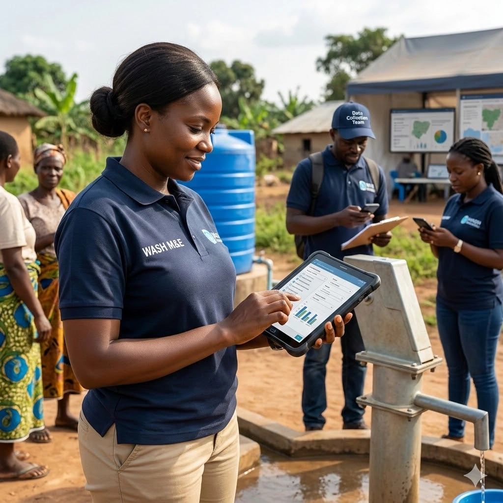
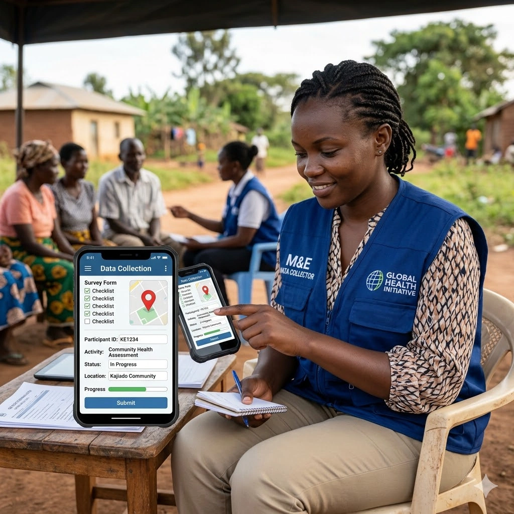
Module 3: Mobile Data Collection for WASH Programs
-
Introduction to mobile data collection tools (e.g., KoboToolbox, ODK, SurveyCTO)
-
Designing WASH-specific survey forms and tools
-
Conducting field assessments using smartphones and tablets
-
Real-Life Application: Mobile data collection WASH use cases
Module 4: Remote Sensing for WASH Monitoring and Environmental Analysis
-
Fundamentals of satellite imagery and remote sensing in WASH
-
Detecting water sources and flood-prone areas
-
Monitoring environmental risks affecting WASH services
-
Practical: Remote sensing WASH monitoring scenarios
Module 5: Data Integration, Visualization, and Decision Support
-
Integrating GIS, mobile, and remote sensing data
-
Developing dashboards for WASH reporting (Power BI, ArcGIS, etc.)
-
Data cleaning, validation, and quality assurance processes
-
Visualization techniques for communicating WASH data
Module 6: Real-Time Monitoring and Early Warning Systems
-
Designing digital platforms for live data feeds
-
Trigger-based alerts for sanitation and water safety monitoring
-
Case Study: Digital monitoring tools in emergency WASH settings
-
Building WASH alert systems for rapid response
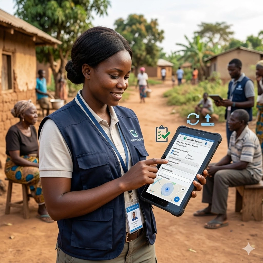
Module 7: Participatory Mapping and Community Engagement
-
Introduction to participatory GIS for WASH
-
Engaging communities in data collection and validation
-
Digital inclusion in WASH monitoring systems
-
Practical: Community-led WASH mapping using open tools
Module 8: Policy, Governance, and Digital Data Ethics in WASH
-
Legal and ethical considerations for digital WASH data
-
Data protection and responsible data use in humanitarian settings
-
Government policies supporting digital WASH monitoring
-
Frameworks for data sharing and interoperability
Module 9: Designing Technology-Driven WASH Monitoring Systems
-
Planning a digital WASH M&E system from scratch
-
Selecting appropriate tools based on program needs
-
Resource and capacity considerations for implementation
-
Group Work: Developing a digital WASH M&E roadmap
Module 10: Case Studies, Presentations, and Action Planning
-
Review of successful GIS for WASH programs
-
Participant presentations on digital monitoring solutions
-
Developing organizational action plans for digital integration
-
Closing discussion and course evaluation
Prerequisites
Course Administration and Investment
Whether you join us in a physical boardroom or through our virtual campus, we’ve designed every administrative detail for a seamless, professional experience.
Our fees are all inclusive during course hours.
- Covered: High level tuition, comprehensive materials (digital + physical), mid morning and afternoon refreshments, a full executive lunch, and any scheduled study visits or site tours.
- Not covered: Travel, visa fees, medical/travel insurance, personal expenses, and accommodation.
From registration to the classroom, we keep things clear and efficient.
- Registration: Find your preferred schedule, click “Register,” complete the form, and submit. Need help? Talk to us directly.
- Pre Course Assessment: After registering, you’ll receive a diagnostic survey to help facilitators tailor content to your needs.
- Joining Instructions: Once fees are paid, you’ll receive a Delegate Welcome Pack at least 7 days before the start date (venue maps, virtual access links, and pre reading materials).
We provide premium environments optimized for adult learning and networking.
- Physical Venues: Premium 4 star and 5 star executive boardrooms across our global host cities, with high tier catering.
- Virtual Instructor Led Training (VILT): High definition, interactive platforms featuring breakout rooms, digital whiteboards, and live technical support.
- NITA and Regulatory Compliance: Administrative processes align with national training authorities.
You’ll leave with tools that extend the course value far beyond the final day.
- ForElite Learner Kit: A physical or digital course manual, proprietary templates, and a curated toolkit of industry standard SOPs.
- On Site / In App Support: Dedicated course coordinators handle technical, dietary, or logistical inquiries in real time.
We validate your commitment to excellence with internationally recognized credentials.
- Attendance Tracking: Rigorous daily logging to meet corporate and regulatory accreditation requirements.
- Verifiable Credentials: Upon successful completion, you receive a certificate of course completion.
Our relationship with you doesn’t end when the course closes.
- Feedback & ROI Reporting: Detailed post course evaluations to give sponsors clear insight into training impact.
- Alumni Network Access: Every delegate joins the ForElite Alumni Network for ongoing peer to peer learning and exclusive webinars.
When is the next intake?
UpdatedWe offer customized training solutions tailored to your organization's specific needs (location, dates, content and team size).
Talk to us and we’ll guide you on the best schedule and format for your team.
Training Methodology
We turn knowledge into results. Using our P.E.A.K. Framework (Prepare, Engage, Apply, Know), every participant leaves with practical skills they can use immediately.
Proven Impact
In the last 12 months, over 1,200 professionals have applied the P.E.A.K. Framework to reduce onboarding time by an average of 30% and accelerate project delivery across 14 industries.
The outcome: Participants don’t just learn. They gain the tools, confidence, and strategy to drive measurable impact.
Tailor-Made Training and Customization
Off-the-shelf solutions rarely fit perfectly. At ForElite Training Institute, we built our Tailor-Made Training (TMT) service to embed our expertise directly into your unique strategy, culture, and operations.
We replace generic examples with scenarios from your sector (e.g., public sector, NGOs, financial services, or logistics).
Choose a format that fits your operations: intensive 3 day bootcamps or weekly sessions that minimize work disruption.
We teach directly from your actual templates, brand guidelines, or financial reports.
Host your bespoke training in any of our 21+ global cities, or we'll send facilitators to your office anywhere in the world.
Course Reviews
Share your experience to help others choose the right course.
Leave a Review
Your review will be published after verification.
Most Recent Reviews
Showing the most recent reviews.
Training on Digital Tools for WASH Data Collection and Monitoring FAQs
Quick answers to common questions about this course
You May Also Be Interested In
Explore more courses in this category
 Advanced
 Intermediate
 Foundation
 Intermediate
Advanced
Intermediate
Foundation
Intermediate
Intermediate
Advanced
Intermediate
Foundation
Intermediate

SECURE YOUR COMPETITIVE ADVANTAGE TODAY.
Subscribe to the Premier Intel newsletter for weekly market insights and training updates.
About Us


ForElite Training Institute is a global institutional capacity-building and EdTech partner that empowers organizations and professionals with transformative, high-impact learning.
Explore
Mastery Tracks
More Mastery Tracks
